Our drone inspection and surveying services offer a one-stop solution for various needs, from the inspection of critical infrastructure to topographic and environmental monitoring studies
We use a variety of advanced sensors and cameras, including high-resolution cameras, thermal imaging sensors, multispectral cameras, and LiDAR, tailored to specific applications. Utilizing advanced sensors and high-resolution cameras, our drones capture detailed data that is both accurate and actionable.
This technology enhances safety by reducing the need for manual inspections in hazardous or hard-to-reach areas. It also improves operational efficiency by covering large areas quickly. The data collected can be seamlessly integrated into existing asset management systems or used for geospatial analysis, predictive maintenance, and compliance checks.
Our Comprehensive drone inspection services are designed for a broad spectrum of organizations, including utility companies, governmental agencies, environmental scientists, and asset managers.
If you're looking for a versatile, safe, and efficient solution for your inspection, surveying, or monitoring needs, our UAV technology is tailored for you.
Opting for our Comprehensive UAV Services offers multiple advantages.
- Safety is significantly enhanced by minimizing the need for manual inspections and human entry into hazardous or hard-to-reach areas.
- Operational efficiency is improved by quickly covering large areas and capturing high-quality data reducing downtime.
- The high-quality data collected is both accurate and actionable, allowing for better decision-making and optimized maintenance schedules.
- The data collected by our UAVs can be seamlessly integrated into existing asset management and monitoring systems for real-time analysis and reporting.
- The versatility of our services means you can address a wide range of needs with a single, integrated solution, saving both time and resources.
Power Line Drone Inspection
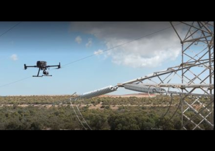
UAVs reduce the need for manual power line inspections improving safety, covering large areas quickly, and enhancing efficiency.
Revolutionize your power line inspections with our cutting-edge UAV inspection services. Our drone technology equipped with high-resolution cameras and thermal imaging sensors provides accurate and actionable data, streamlining your asset management processes.
UAV Inspection | Confined Spaces
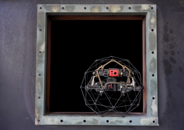
Transform your approach to confined space inspections with our specialized UAV services. Focused on enhancing safety and minimizing the need for human entry, our drone inspection technology provides accurate and actionable data for pressure vessels, tanks, and ship hulls.
UAV Inspection | Fugitive Emissions Monitoring
Applus+ drone inspection services for Fugitive Emissions Monitoring assist our clients in taking control of their environmental compliance. Designed for accuracy, safety, and efficiency, our drone technology provides real-time data to help you identify and manage unauthorized emissions effectively.
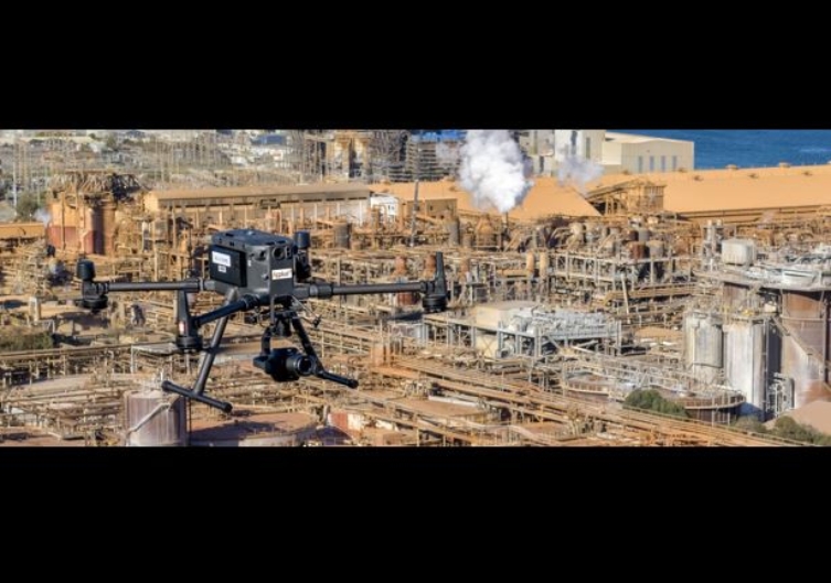
UAV Inspection | Infrastructures
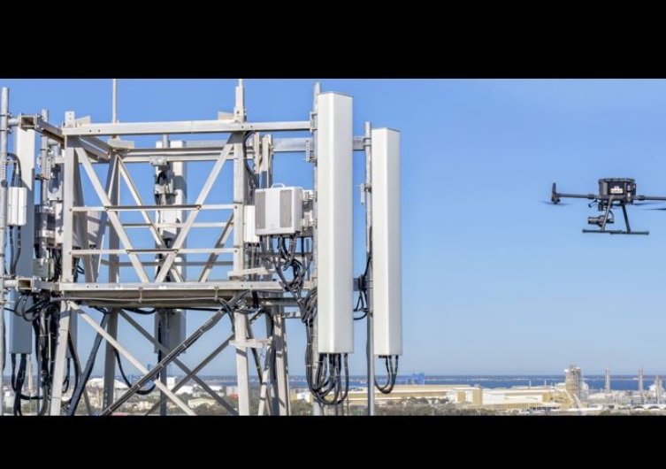
UAVs can inspect a variety of critical infrastructure, including flares, power lines, bridges, jetties, dams, pipelines, and communication towers.
Applus+ drone inspection technologies allow for comprehensive and secure inspections of critical infrastructure. Our services provide a reliable, efficient, and cost-effective solution for inspecting assets that are difficult to access or pose safety risks.
UAV Topographic Survey

Surveying UAVs can cover large areas quickly and are equipped with advanced sensors, improving the speed, safety, and accuracy of topographical surveys.
Applus+ advanced UAV surveying services are designed for efficiency and accuracy providing high-quality spatial data that can be seamlessly integrated into your geospatial analysis and land mapping projects.
Wind Turbine Drone Inspection | Solar Panel Drone Inspection
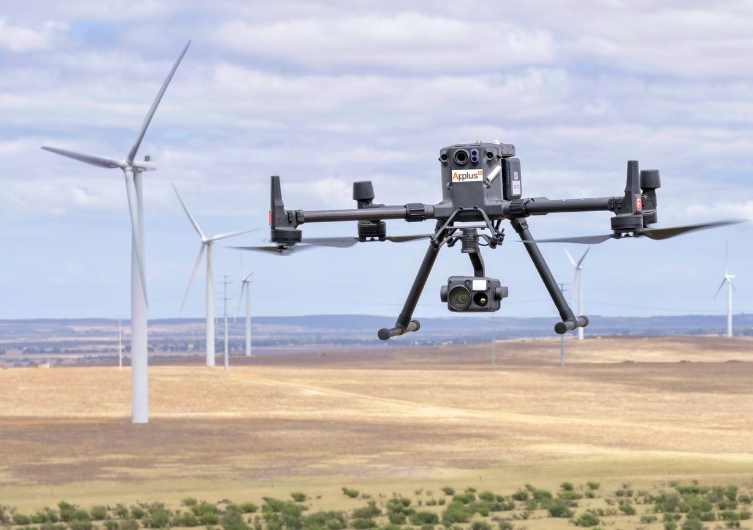
UAVs can inspect wind turbines and solar panels quickly and efficiently, reducing downtime and enabling real-time assessments.
Elevate your renewable energy asset management with our specialized UAV inspection services for wind turbines and solar panels. Designed for safety, efficiency, and accuracy, our drone technology provides comprehensive inspections that drive operational excellence.